Destination
The South of Bacalar Lagoon: Between the Town and Xul-Há
Discover the southern end of Bacalar Lagoon, between town and Xul-Há: deep, still waters, less boat traffic, unbroken jungle and unforgettable sunsets.
Another Bacalar: The Stretch Between Town and Xul-Há
When people talk about Bacalar, nearly every image in circulation belongs to the northern and central lagoon: the docks facing the town, the luminous turquoise shallows, the lakeside swimming spots crowded with kayaks. But the lagoon runs some 42 kilometers long, and along its final stretch — from the outskirts of town to the village of Xul-Há at the far southern end — there is another Bacalar, less photographed and, for many, deeper in every sense of the word. It is a strip where the Chetumal-Bacalar federal highway runs parallel to the water, the low jungle reaches almost to the shoreline, and the developments can be counted on one hand.
The south of Bacalar Lagoon is not a lesser version of the north; it has a character all its own. Here the body of water narrows and gains depth, submerged cenotes stain the bottom in blues verging on violet, and silence is the rule rather than the exception. First-time visitors to this stretch tend to describe the same feeling: that of having found the lagoon before the lagoon — a section that keeps the scale, the calm, and the dark night skies the rest of the destination is gradually losing as it grows.
That difference is no accident. Geography, the depth of the water, and just the right distance from town — about fifteen minutes by road — have made the south a territory apart, with its own rules of light, current, and life.
Deep, Still Waters in Intense Shades of Blue
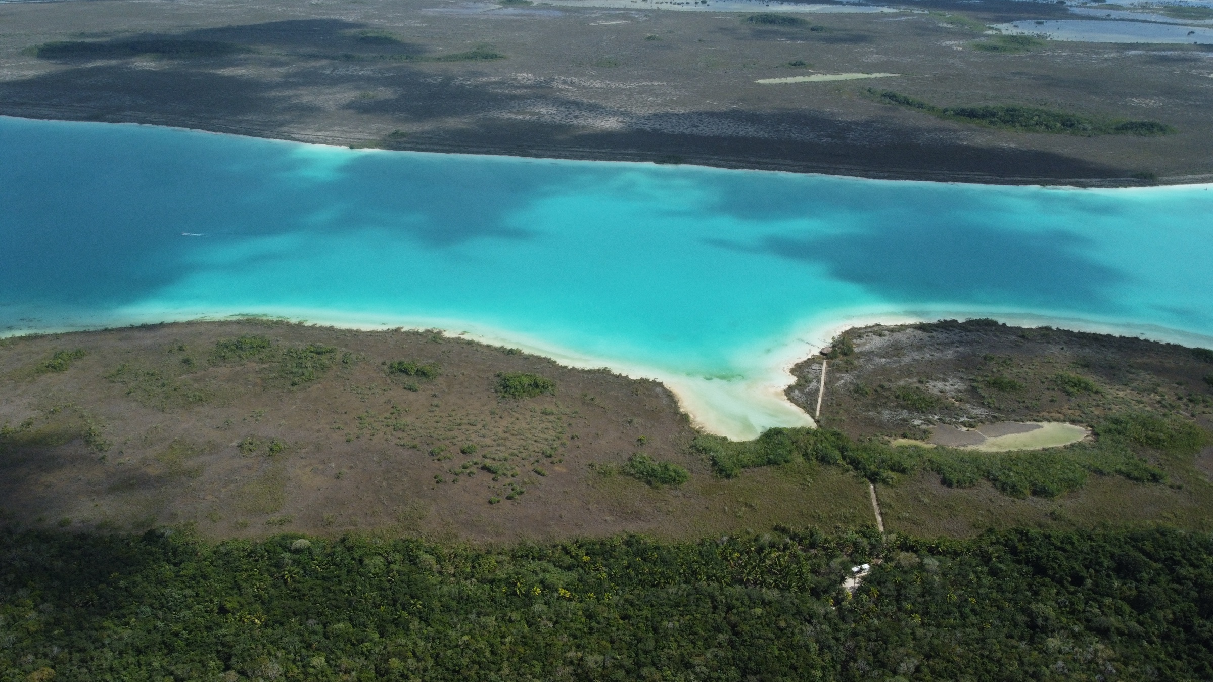
The first difference is visible from the water itself. While the north and center offer luminous, white-bottomed shallows, the south is the domain of depth: this is where the lagoon reaches its deepest points, and that depth translates into color. The water absorbs the warm tones of the light and gives back saturated, dense blues that edge toward cobalt at midday and turn almost ink-dark by late afternoon. These are not the postcard turquoises of the pirates' channel; they are serious blues, of an intensity that surprises even those who already know the rest of the lagoon.
The second difference is something you hear — or rather, don't. Most boat and pontoon tours cluster in front of the town, so boat traffic in the south is markedly lighter. The result is a mirror-still surface for much of the day, ideal for kayaking, dinghy sailing, paddleboarding, or simply swimming in fresh water without anyone else's wake. For the stromatolites — those living reefs of microorganisms that rank among the oldest life forms on the planet — that calm matters too: less artificial chop and less stirred-up sediment mean a healthier, more intact ecosystem.
And then there is the light at day's end. In the south, sunsets fall across the water with a breadth the town, with its waterfront promenade and its bustle, no longer allows: the sky catches fire, the surface mirrors it, and the jungle along the shore turns to silhouette. It is a daily spectacle — free, and still almost private.
Xul-Há and the Rapids: The Lagoon's Living Edge
At the southern tip of the lagoon sits Xul-Há, a small village whose Maya name is usually translated as "where the water ends." And it is literal: here the Lagoon of Seven Colors narrows into a channel connecting it to the Chetumal lagoon, and in that narrowing the water — always gentle — picks up speed. These are the so-called southern rapids: a soft, crystal-clear current running between jungle banks and colonies of stromatolites, where you can let yourself drift and watch the bottom in detail so sharp it seems unreal.
For many visitors, the Xul-Há rapids are the single most memorable experience in all of Bacalar, precisely because they bring together everything that defines the south: transparent water, untouched nature, and a human scale — no crowded docks, no lines of tour boats. Around them survive family-run eateries, wooden palapas, and simple entry points to the water that recall what the entire destination was like just a few years ago.
Living near Xul-Há means having this stretch — the liveliest and best preserved on the lagoon — a few minutes from home, while sitting at the very point where southern Quintana Roo comes together: halfway between the Pueblo Mágico of Bacalar and the state capital.
Well Connected: Federal Highway, Tren Maya, and Three Airports
Despite what its calm might suggest, the southern lagoon is probably the best-connected stretch in all of Bacalar. The Chetumal-Bacalar federal highway runs right through this corridor, so access is direct, paved, and detour-free: about fifteen minutes north to the town of Bacalar, and thirty to forty minutes south to Chetumal, with its airport, hospitals, universities, and all the services of a state capital. Few areas of the lagoon offer that double proximity without sacrificing privacy.
Regional connectivity, moreover, has changed in scale over the past few years. The Tren Maya is now operating with a station in Bacalar, linking southern Quintana Roo to the rest of the peninsula; Tulum's international airport is up and running, dramatically shortening arrivals from other cities and countries; and Cancún's airport, the great hub of the Mexican Caribbean, is about four and a half to five hours away by road. Add to that the public opening of the Ichkabal archaeological site — a monumental Maya city a short distance from Bacalar — which is redrawing the region's tourism map.
For the southern lagoon, all of this means something very concrete: you can be in the quietest part of the destination without being far from anything.
What the South Looks Like Today — and Where It's Headed
Today, the south of Bacalar Lagoon is still mostly jungle. Between the town and Xul-Há, long stretches of unbroken vegetation alternate with a handful of ranches and discreet homes by the water, small low-key hotels, and private entrances barely hinted at from the highway. There are no boardwalks, no commercial strips, no towers: the shoreline keeps its green line, and the nights keep their darkness. That low density is not neglect; increasingly, it is the deliberate choice of those who have been arriving in the area looking for exactly that.
Where it is headed is the interesting question. The combination of new infrastructure — train, airports, Ichkabal — with land still largely untouched suggests the south will concentrate the destination's most careful growth: low-rise projects, generous proportions of green space, and a residential rather than mass-tourism vocation. The very character of the water helps: a zone of deep, still lagoon with no swimming-beach shallows lends itself less to high-volume tourism and more to those who come to stay, to swim early, and to watch the sunset from their own dock.
The challenge, as everywhere on the lagoon, will be to grow without breaking the balance: protecting the stromatolites, treating the water, keeping the jungle as the backdrop. The projects that understand this from the design stage will be the ones that define the south's next chapter.
Living the South: Where the Lagoon Keeps Its Best
In the end, the southern lagoon comes down to an equation that is hard to replicate: Bacalar's deepest blues, its stillest water, the Xul-Há rapids a few minutes away, unbroken jungle as a permanent neighbor — and yet a federal highway that puts the town fifteen minutes away and a capital city with an airport little more than half an hour off. It is the part of the lagoon that offers silence and connection at once; nature nearly intact, and direct access. Those who seek out Bacalar to live it — not just to visit — sooner or later end up looking south.
That is exactly where The Reserve Bacalar rises: a private residential community on the southern lagoon committed to that balance of jungle, water, and low density. The project brings together an international-caliber hotel immersed in rivers created within the development, a Day Club with direct access to the lagoon, Branded Residences, and residential lots starting at 200 m², designed for those who want a piece of this stretch of water before it stops being a secret. The south has always kept the best of Bacalar; the difference is that now, for the first time, it also offers a way to stay.
Frequently asked questions
Where is Xul-Há, and what makes it special?+
Xul-Há is a village at the far southern end of Bacalar Lagoon, on the Chetumal-Bacalar federal highway. Its Maya name is usually translated as "where the water ends." It is famous for its rapids: a gentle, crystal-clear channel surrounded by jungle and stromatolites, considered by many the most memorable experience on the entire lagoon.
What sets the south of Bacalar Lagoon apart from the north?+
The south is the deepest, stillest part of the lagoon: its waters show intense, near-cobalt blues, and it sees far less boat traffic than the north, where most tours operate. It also keeps unbroken jungle along the shore, greater privacy, and wide-open sunsets over the water, with the town of Bacalar about fifteen minutes away by road.
How do you get to the south of Bacalar Lagoon?+
Access is direct via the Chetumal-Bacalar federal highway, which runs through this corridor. From Chetumal and its airport it takes about 30-40 minutes; from the town of Bacalar, about 15. The Tren Maya is already operating with a station in Bacalar, Tulum's international airport is up and running, and Cancún's is about 4.5-5 hours away by road.
Can you swim in the Xul-Há rapids?+
Yes. The rapids are a gentle current of clear fresh water where you can float and let yourself drift. Do it with respect, though: never step on or touch the stromatolites, skip conventional sunscreens, and avoid stirring up the sediment on the bottom — this is a fragile ecosystem home to life forms thousands of years old.
Why is the south considered the part of Bacalar with the brightest future?+
Because it pairs land still dominated by jungle with the destination's best connectivity: a direct federal highway, proximity to Chetumal and the town, the Tren Maya, the Tulum and Chetumal airports in operation, and the opening of the Ichkabal archaeological site. Everything points to low-density, residential rather than mass-scale growth that respects the lagoon.
Live Bacalar front-row
Discover The Reserve, a luxury community in the south of the Lagoon of Seven Colors.
Discover the project